Our Region
The Shire is part of the Goldfields-Esperance region and is one of the nine regions of Western Australia. It is located in the south-eastern corner of Western Australia and comprises the local government areas of Coolgardie, Kambalda, Dundas, Esperance, Kalgoorlie-Boulder, Laverton, Leonora, Menzies, Ngaanyatjarraku and Ravensthorpe.
The Shire of Ngaanyatjarraku is part of the Goldfields Voluntary Regional Organisation of Councils (GVROC), which was formed in 2007. The overarching principle of GVROC is to create a strategic alliance of Local Governments that contribute and work together to ensure the development and retention of infrastructure and community services and undertake joint economic development initiatives through grant funding with the State and Federal governments plus the private sector to benefit the region.
The mining and processing of mineral resources is the primary industry within the region, complemented by the subsequent commercial services. The region also has a strong agricultural industry, as well as a focus on tourism particularly in the southern parts of the region.
The Shire encompasses an area of 159,948 square kilometres and is located approximately 1,542km from Perth. The region itself is diverse in natural beauty, from the magnificent Rawlinson ranges to the red sandy plains of the Gibson Desert.
The Shire is a unique local government in that its community of interest is contained within the traditional lands of the Ngaanyatjarra people of the Central Desert of Western Australia. The 99-year leases held by the Ngaanyatjarra Land Council on behalf of the traditional owners also form the boundaries of the Shire of Ngaanyatjarraku.
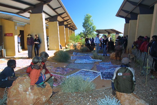
The Shire’s main township is Warburton, which is also the largest of the 11 Indigenous communities within the Shire. Warburton is positioned 1,542 km northeast of Perth, 560 km of gravel road northeast of Laverton, 750 km northeast of Kalgoorlie and 1,050 km southwest of Alice Springs. Neighbouring shires include the Shire of Wiluna, Laverton, and East Pilbara. The Shire offices are located in the Tjulyuru Cultural and Civic Centre in Warburton.
In the 2021 Census, the Shire had an estimated residential population of 1,358 people, comprised of 48.5% male and 51.5% female residents, and there are approximately 599 residential dwellings within the Shire. The Shire has a higher percentage of residents aged between 0-29 years and a lower proportion of residents aged 65+ years compared with the wider Australian population. This must be a consideration for the Shire when considering the types of service provision to the community.
The distinctive red sand and blue skies of the area form a spectacular context for a diverse range of desert flora and fauna. Rocky escarpments and other landforms give texture to this beautiful desert country.
